Geographic Information System (GIS), in recent years, is being used widely to help researchers integrate, manage and analyze both spatial and non-spatial data in biological field stations. SiteLocator, a user-friendly tool, is developed to help the biologists or the researchers to identify their research areas based on the different spatial data in Bath Field Station, Ohio. This stand-alone tool is developed using MapObjects within the Visual Basic Environment.
Biological research stations are growing in number and becoming more sophisticated in the services they provide. GIS and Database Management Systems (DBMS) are mechanisms available to promote the integration of data, information and knowledge at the field stations (Wentz and Bishop, 1992).
Techniques associated with GIS and DBMS are not new to research and government agencies. Their popularity also extends into various disciplines including geography, ecology and biology (Cromley and Cromley, 1987). In these fields GIS allows for the combinations of diverse, geographically referenced data in a computer environment for storage, query and analysis. Additionally, GIS provides users with a structured environment in which data from various sources can be integrated and analyzed. For example, it becomes possible to examine impacts of socioeconomic development on biological conservation (Scott et. al. 1993, Sadar, Stone, and Joyce 1990). Before the availability of such tools, combining data from multiple sources was difficult and often not attempted. Tool such as GIS/DBMS in the data collection environment makes this possible.
Site selection at any biological station is challenging and difficult because of the many variables to be considered: surface topography, trails, and existing research plots. Researchers may wish to locate a study area in a region that can be cleared; thus criteria might include presence of alluvial soils, little change in slope and a specified distance from trails.
This paper shows how SiteLocator has been developed and how it can help the researchers identify the study areas at Bath Field Station, Ohio. Traditional way of identifying the areas is time consuming and difficult, and even identifying the areas using most sophisticated GIS software requires good knowledge on GIS and the software. Most researchers are not trained in the use of GIS and may not have or wish to take the time to be trained in the technical aspects of GIS. In fact, many are not even aware of the hours required to design applications, enter data, perform analyses, and output the products typical to basic GIS projects. Considering those facts, SiteLocator has been designed as an easy-to-use and user-friendly interface which
The University of Akron has entered a partnership with the township of Bath to develop a field station and maintain a nature preserve on a 400 acres tract of the old Firestone estate (formerly the country estate of tire magnate Raymond Firestone). This preserve will maintain a mixture of natural habitats: grasslands, mesophytic deciduous forests, riparian forests, wetlands, peatlands, ponds, and streams encompassing the wide range of the habitat types found in Northeastern Ohio. Notably, it has very few of the invasive plant and animal species that plague many nearby natural areas, including garlic mustard, purple loosestrife, common reed, Japasese knotweed, and introduced honeysuckle. Because of the unique opportunity of study and preserve important habitats and biodiversity of provided by this property, Bath Township and the University of Akron will work together to preserve it for future generations. The University has begun planning and raising funds for a field-station that will facilitate inter-disciplinary study of the biology, geology, geography, and anthropology of the area (http://www.uakron.edu/biology/bath.html).
|
| Figure 1: Location Map of Bath Field Station |
The field station and preserve will benefit the region by allowing education of students in the techniques of modern science, research on fundamental questions about the environment, and providing an improved capacity to monitor the Cuyahoga River Valley watershed (which has recently been designated a "national heritage river"). The Bath Preserve and Field Station will provide Ohio students and the public a unique opportunity to preserve, study, and enjoy a diverse, natural habitat in Northeastern Ohio. The vision is to use public education and research to help encourage preservation and protection of our natural wealth, ant that this will help to maximize the likelihood that the Bath Nature Preserve and Field Station will remain undisturbed well into the next century (http://www.uakron.edu/biology/bath.htm).
The main purpose of SiteLocator is to help biologist, students or researchers identify research plots based on different criteria. Besides this, it provides some basic GIS functionality. Functions are
Data for Bath Field Station are collected from a variety of secondary sources. The spatial data are stored in ESRI Shape File format (.shp) and the associated attributes of the features are stored in the dBase (.dbf) files associated with the shape (.shp) file. Since the shape files are easily manageable with MapObjects and can easily be editable in ArcView, all the spatial data are stored in shape files. All the shape files required for SiteLocator are stored under a specified folder (<Drive:>\<ApplicationPath>\ShpFiles). For this development, only four types of data (Trails, Elevation, Slope and Soil Types) have been used here. The database has been designed with such flexibility that it can easily be updated with new datasets at anytime without modifying programming code.
An Access database (named setup.mdb), resides in the application path and is used to play the key role. It helps SiteLocator to identify how many layers will be used and their relative path. The database also maintains different tables to store unique values for each layer and their legend. The Color of each legend is stored as 9 digit RGB values.
 |
| Figure 2: Role of the setup database |
SiteLocator is developed using MapObjects (an OLE product of ESRI) within a Visual Basic environment. MapObjects, in combination with Visual Basic, is now becoming standard development platform for GIS application development because of its easy-to-development and robust capabilities. Compared with other GIS applications developed with AML or Avenue, applications developed with Visual Basic and MapObjects have some significant advantages. First, it is easier to design the interface and build programs with VB and MapObjects. Developers can apply nearly any OLE automation objects provided by Microsoft or other vendors into an application. Second, the application will have a small memory footprint. VB EXE files consume a small to modest portion of the system's memory. Third, MapObjects draws geographic features on the Map control and performs GIS analysis much quicker than any other windows mapping software. Another important advantage is, with VB Database Jet Engine the application can handle large database queries and can search with extreme speed (Lombard, 1997).
Interface: To make SiteLocator simple and easy-to-use for the researchers, it has been developed on a single interface. The layers are added at the opening without any interaction from the users. It only allows the users to make the layers visible/invisible, active/inactive, and select features or generate buffers, and finally create the polygons representing the research plots (those that meet all the criteria chosen by the user).
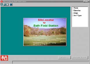 |
| Figure 3: Initial Interface of SiteLocator |
Forms: Two types of Forms are used to develop this tool.
| Form Name | Description |
|---|---|
| FrmSplash | This form is used to splash an image while the software being loaded at the beginning. This window will also show some information "About SiteLocator". |
| FrmMain | This form is used to develop the interface of the software. The users will interact with this form to locate the plots. It has the controls to display the map, query the features, zoom or pan, identify the research sites and save the site in a shape file. |
Controls: Controls are the visual objects of Visual Basic (VB) on which users interact to run the functions and get the job done. Controls (sometimes called ActiveX) are stored in .OCXfile. VB, itself, has some controls that come along with the software. These controls are fine to develop interface and database management tools. But to add the functions that will do the GIS tasks, some other ActiveX controls from 3rd party developers are required, otherwise developing those GIS functions from the scratch will take huge time. For SiteLocator, ESRI MapObjects is used to add GIS functionality because of the familiarity of ESRI database and its robust capabilities. Followings are the controls that used to develop this tool.
 |
| Figure 4: Buffer generated by SiteLocator |
| Control Type | Purpose |
|---|---|
| Map (1) | This is the only control of MapObjects with which users can interact. This control helps to display the shape file, to query the features, to select the features, to zoom or pan and to add graphics. On SiteLocator's interface, this is main control. |
| ListBox (2) | SiteLocator has two ListBox(s). One
shows the list of the layers available. The users
interact with it to make layer(s) visible/invisible and
to active. The second one displays the unique values of the active layer (highlighted). The value(s) that is selected here, the associated features are highlighted on the Map. |
| TextBox (1) | The only TextBox allows enter the buffer distance. And when a user presses ENTER, the buffer for the active arc layer is created and displayed on the Map. |
| Label (2) | It adds some text to the form. |
| ToolBar (1) | It contains the Tools to help zoom and pan around the Map. |
| CommandButton (2) | One button (named Quick View) identifies the
research sites. The other one (named Save...) saves the output research sites in a shape file. |
| CommonDialog (1) | While saving into a shape file, it allows users to browse through the folders and choose the output file name. |
| ProgressBar (1) | It shows the status of locating the sites and of saving the sites into a shape file. |
 |
| Figure 5: Selecting certain elevation of Bath Field Station |
|
| Figure 6: Method to identify the research plots |
|
| Figure 7: Output of SiteLocator- Research Plot(in magenta) |
"The explosion in Internet and WWW use has prompted thousands of organizations to build Web sites and home pages. The Web is a compelling and cost-effective way to share information within an organization or provide public access to information worldwide on the Internet." (ESRI, 1996). As the Internet is becoming a standard and quick medium to access information, SiteLocator can be enhanced to make it accessible from the Internet. One important advantage of using MapObjects as the development platform is that with simple modification, it can easily be made a map server that can be reached to a large number of people.
There are many similarities between Bath Field Station and other field-based research facilities. On-site facilities provide many benefits by addressing both researcher and administration needs - creating a framework for multidisciplinary research and providing for easy and uniform archiving of data. One of the first things a researcher may need is to locate their desired research sites. SiteLocator can meet his demand quickly. So, this development can be the first step to meet the needs of implementing a software and administrative system that institutionalizes data sharing and standardization by providing a framework for storage and analysis both on-site and off-site.
Cromley, E. K. and R. G. Cromley, 1987. A GIS for local health services planning. Proceedings, International GIS Symposium 3:551.
Lombard, K., 1997. Application Development with MapObjects and Visual Basic. Proceedings, Thirteenth Annual ESRI User Conference. Redlands, Calif.: Environmental Systems Research Institute. ( http://www.esri.com/library/userconf/proc97/proc97/to350/pap325/p325.htm)
K. Lombard and M. McKnight. 1998. Extending Object Oriented Concepts to Design a Complex GIS Application. Proceedings, Thirteenth Annual ESRI User Conference. Redlands, Calif.: Environmental Systems Research Institute. ( http://www.esri.com/library/userconf/proc98/PROCEED/TO850/PAP817/P817.HTM)
Sader, S. A., T. A. Stone, and A. T. Joyce. 1990. Remote Sensing of tropical forests: An overview of research and applications using non-photographic sensors. Photogrammetric Engineering and Remote Sensing 56: 1343-51
Scott, J. M., F. Davis, B. Csuti, R. Noss, B. Butterfield, C. Groves, H. Anderson, S. Caisso, F. D'Erchia, T.C. Edwards Jr., J. Ulliman, and R. G. Wright. 1993. Gap analysis: a geographical approach to protection of biological diversity. Wildlife Monograph no. 123 (41 pp.). Bethesda, Md.: The Wildlife Society.
Wentz, E. A. and Bishop, J. A. 1993. "Geographic Information System and Database Management at a Tropical Rainforest Research Station". Environmental Information Management and Analysis: Ecosystem to Global Scales proceedings, sponsored by the National Science Foundation, Albuquerque, New Mexico.
Wentz, E. A. and M. V. Castro Campos. 1993 (May). Management of research areas at a biological field station. Proceedings, Thirteenth Annual ESRI User Conference 1:303-14. Redlands, Calif.: Environmental Systems Research Institute.